
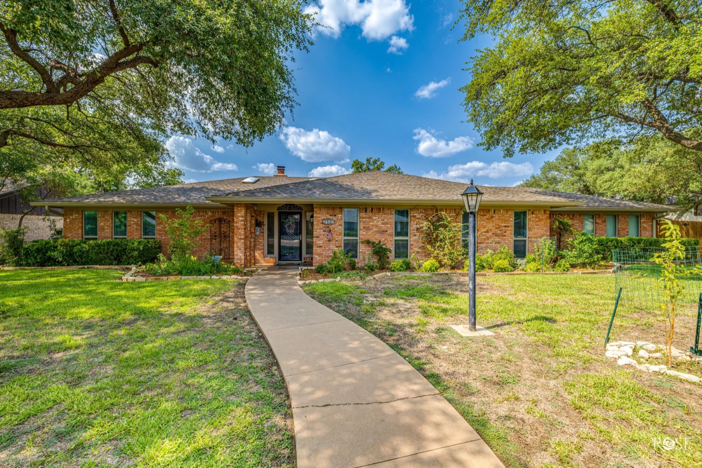
Santa Rita is the in-town neighborhood between downtown and Angelo State: houses from the 1920s through the 1950s, pier-and-beam foundations, hardwood floors, and trees that have had a century to grow. It borders the Angelo Heights Historic District, which is on the National Register of Historic Places. If you want a house with some age on it, this is where San Angelo keeps them.
Build era as described by local brokerages; confirm on the appraisal district record. Distance measured by routing software from Santa Rita Elementary. National Register date from the National Park Service.
The housing
The typical Santa Rita house was built between the 1920s and the 1950s, sits on a pier-and-beam foundation, and has hardwood floors under whatever the last owner put down. The neighborhood takes its name from the Santa Rita No. 1 oil well.
Next door, the Angelo Heights Historic District covers the blocks roughly bounded by Colorado Street, the North Concho River, Live Oak Street, South Bishop Street, Twohig Street, and South Washington Street. It was listed on the National Register on November 25, 1988, for its Late Victorian and early 20th-century Revival architecture, with periods of significance running from 1900 to 1949. It developed from about 1905 through the late-1920s oil boom.
Houses this age vary one by one, so see current listings and compare condition, not just square footage.
What's nearby
By road from Santa Rita Elementary: Angelo State University is about 1.3 miles, downtown 1.7 miles, Shannon Medical Center 1.9 miles, and Goodfellow Air Force Base about 4 miles.
- The Concho River Walk: about four miles of paths and gardens along the North Concho from West 14th Street to Rio Concho Drive, with the RiverStage amphitheater. The American Planning Association named it one of its Great Public Spaces in 2017.
- Downtown: a Texas Main Street city since November 2005, managed by Downtown San Angelo, Inc.
- Fort Concho: the 1867 frontier post at 72 West College Avenue, a National Historic Landmark with 16 original buildings, run as a city museum since 1935.
Schools
Santa Rita is in San Angelo ISD: 14 elementary schools, 3 middle schools, and 2 high schools, Central and Lake View, with about 13,000 students.
Santa Rita Elementary shares the neighborhood's name. Campuses are assigned by address: check the attendance zone maps on saisd.org, and note that new elementary boundaries take effect July 1, 2027.
District size from San Angelo ISD and the National Center for Education Statistics.
Taxes
Santa Rita is inside the city limits, so three taxing units apply: the school district, the city, and the county. These are the 2025 adopted rates.
| Taxing unit | 2025 rate per $100 |
|---|---|
| San Angelo ISD | $1.0706 |
| City of San Angelo | $0.7947 |
| Tom Green County | $0.4708 |
| Combined | $2.3361 |
Tom Green County 2025 Truth in Taxation summary. Homes outside the city limits skip the city rate; the appraisal district's tax estimator runs the numbers on an actual parcel.
If it will be your primary residence, file for the $140,000 school homestead exemption (Form 50-114, generally before May 1); it also caps your taxable value growth at 10 percent a year.
Things to know before you buy
- National Register listing does not tie your hands. Under federal law, listing places no restrictions on what a non-federal owner may do with the property, unless federal money or permits are involved. State or local rules can still apply.
- The city does review locally designated landmarks and districts. San Angelo's Historic Preservation Commission dates to 1993 and was merged with the River Corridor Commission in 2012 into the Design and Historic Review Commission, which reviews exterior changes to designated landmarks and districts through a Certificate of Appropriateness. Ask the city's Planning and Development Services whether a specific address is locally designated before you plan a facade project.
- Pier-and-beam and old wiring mean a real inspection. Ask when the roof, wiring, and sewer line were last replaced.
- Watering rules cover the whole city. Standard conservation allows outdoor watering twice every seven days from April through October, once every seven days from November through March, never between noon and 6 pm, and no more than 1 inch per week.
For the in-town feel further out, read College Hills, beside Angelo State. For the southwest side, Southland and Bentwood. The first-time buyer guide covers the Texas-specific parts, and the relocation guide covers the rest of the city.
Questions people ask
How old are the homes in Santa Rita?
Most were built between the 1920s and the 1950s, typically on pier-and-beam foundations with hardwood floors. The adjacent Angelo Heights Historic District dates from about 1905 through the late-1920s oil boom.
Is Santa Rita a historic district with rules on what I can change?
The National Register listing for Angelo Heights, the district next to Santa Rita, places no federal restrictions on what a private owner can do. The City of San Angelo does have a Design and Historic Review Commission for locally designated landmarks and districts, so check with the city's Planning department for any specific address.
What are the schools like in Santa Rita?
The neighborhood is in San Angelo ISD, and Santa Rita Elementary shares its name. Campus assignments depend on the address, and elementary boundaries change on July 1, 2027.
How close is Santa Rita to downtown?
About 1.7 miles by road from Santa Rita Elementary to downtown, roughly 4 minutes. Angelo State University is about 1.3 miles and Shannon Medical Center about 1.9 miles.