
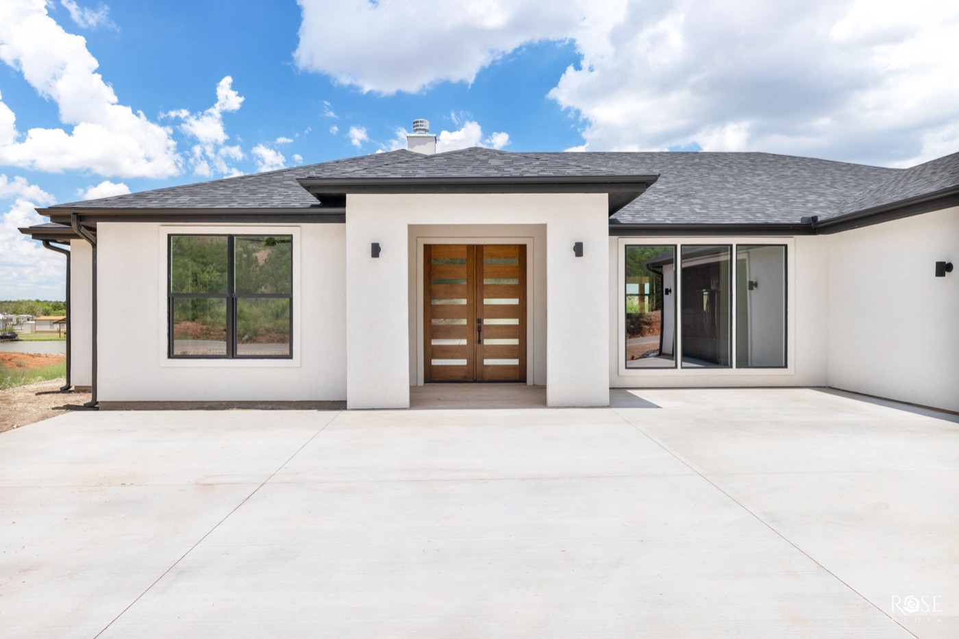
The Bluffs is the hillside subdivision on San Angelo's west side, built from the 1980s onward, where the upper streets look out over O.C. Fisher Reservoir and back up to San Angelo State Park. It is about six miles from downtown by road, and about six miles the other way to the park's south gate.
Build era from local brokerage descriptions of the subdivision. Drive distance by road routing from the center of The Bluffs to downtown, 2026. Trail mileage from Texas Parks and Wildlife.
The housing
The Bluffs is really two neighborhoods stacked on one hill. The lower Bluffs is mostly single-story ranch-style homes. The upper Bluffs climbs toward the park boundary with larger homes, bigger lots, and newer construction, and some of those lots back directly to San Angelo State Park with nothing built behind them.
Because building has continued from the 1980s to the present, you will find three decades of styles on the same street grid: brick ranches, 1990s two-stories, and current stucco and stone builds. Flat lots and view lots are different products and trade differently. See current listings for what is on the market this week.
What's nearby
- San Angelo State Park, headquartered at 362 S. FM 2288, about 6.2 miles by road from the middle of the neighborhood. Between its North and South units the park has 50 miles of multiuse trails for hiking, mountain biking, and horseback riding, the Texas State Bison Herd and Longhorn Herd in paddocks, and a two-mile Dinosaur Trail past fossil trackways from the Permian age. Campsites with utilities, primitive sites, log cabins, a group bunkhouse, and equestrian camping are all inside the park.
- O.C. Fisher Reservoir, the water the park sits on, is one of the city's raw-water sources alongside O.H. Ivie, the Twin Buttes and Lake Nasworthy system, and the Hickory Aquifer.
- Twin Buttes Reservoir, about 8 miles southwest of the city and about 9,000 surface acres, operated by the Bureau of Reclamation.
- Downtown is about 5.8 miles by road, and Goodfellow Air Force Base about 7.8 miles.
Schools
The Bluffs is in San Angelo ISD, which runs 14 elementary schools, 3 middle schools, and 2 high schools, Central and Lake View, for about 13,000 students. Confirm the campus assignment for any specific address with the district.
Taxes
A home in The Bluffs inside the city limits pays three taxing units: the school district, the city, and the county. The 2025 adopted rates, per $100 of taxable value:
| Taxing unit | 2025 rate per $100 |
|---|---|
| San Angelo ISD | $1.0706 |
| City of San Angelo | $0.7947 |
| Tom Green County | $0.4708 |
| Combined | $2.3361 |
Tom Green County 2025 Truth in Taxation summary. The city rate rose in 2025 because of the voter-approved coliseum bond, and the city has proposed holding it flat for 2026. Pull the parcel on the Tom Green Central Appraisal District site to see exactly which units apply and to run its tax estimator.
Things to know before you buy
- If the house will be your primary residence, file the homestead exemption (Form 50-114, generally due before May 1). The school district exemption is $140,000, and once it is in place your taxable value cannot rise more than 10 percent a year.
- The state park is a paid park, not a city greenbelt: $4 a day for adults, free for children 12 and under. The South Shore gatehouse is open 8:30 a.m. to 4:30 p.m. daily, and the North Shore gate stays locked; you check in at the South Shore to get the code.
- Twin Buttes, the other big water to the southwest, requires a Limited Public Use permit ($12 a year, age 17 and up) to fish, hike, camp, or picnic, sold through Texas Parks and Wildlife's public hunting program and expiring each August 31.
- San Angelo plans its year around water. Drought restrictions happen; check the city's current stage before you plan a lawn on a hill lot.
Where to go from here
If The Bluffs is on your list, the other southwest and west-side pages are the natural comparisons: Bentwood around the country club, Southland with its mature trees, and Lake Nasworthy if you would rather have water than a hill. New to the city altogether? Start with the relocation guide, and if this is your first purchase, the first-time buyer guide covers the Texas-specific parts.
Questions people ask
Where is The Bluffs in San Angelo?
On the west side of the city, on the hills above O.C. Fisher Reservoir. By road it is about 5.8 miles to downtown and about 6.2 miles to the San Angelo State Park headquarters at 362 S. FM 2288.
When were the homes in The Bluffs built?
From the 1980s to the present. The lower Bluffs is mostly ranch-style homes; the upper Bluffs has larger homes on the hill, some backing directly to San Angelo State Park.
What school district is The Bluffs in?
San Angelo ISD. Confirm the campus assignment for a specific address with the district.
What is the property tax rate in The Bluffs?
For a home inside the city limits in San Angelo ISD, the 2025 adopted rates were $1.0706 for the school district, $0.7947 for the city, and $0.4708 for Tom Green County, about $2.34 per $100 of taxable value before exemptions.
What is there to do at San Angelo State Park?
The park has 50 miles of multiuse trails for hiking, mountain biking, and horseback riding, the Texas State Bison Herd and Longhorn Herd paddocks, a two-mile Dinosaur Trail with Permian-age fossil trackways, and camping, cabins, and equestrian sites. Adult day entry is $4; children 12 and under are free.